Holy Roman Empire: Map & Borders Over Time
Holy Roman Empire appears on 10 of the 39 border maps, from 1000 to 1700. Its mapped territory was largest in 1300, at roughly 920,000 km². Chronica Maps groups it with the HRE / Germany lineage, shown in the same colour across periods.
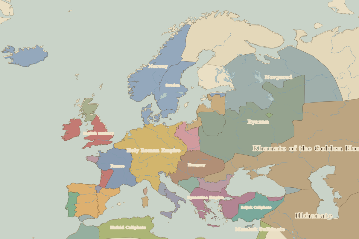
Open 1300 in the interactive map
Territory of Holy Roman Empire over time
Approximate area on each border map.
| Map year | Approx. area | Change |
|---|---|---|
| 1000 | 700,000 km² | – |
| 1100 | 620,000 km² | -11% |
| 1200 | 620,000 km² | +0% |
| 1300 | 920,000 km² | +47% |
| 1400 | 920,000 km² | 0% |
| 1492 | 850,000 km² | -7% |
| 1500 | 850,000 km² | +0% |
| 1600 | 670,000 km² | -21% |
| 1650 | 630,000 km² | -7% |
| 1700 | 610,000 km² | -3% |
Cities within Holy Roman Empire in 1300
Rulers (Franks / HRE / Germany)
| Reign | Ruler |
|---|---|
| 983–1002 | Otto III |
| 1002–1024 | Henry II |
| 1024–1039 | Conrad II |
| 1039–1056 | Henry III |
| 1056–1106 | Henry IV |
| 1106–1125 | Henry V |
| 1125–1137 | Lothair III |
| 1138–1152 | Conrad III |
| 1152–1190 | Frederick I Barbarossa |
| 1190–1197 | Henry VI |
| 1198–1211 | Throne dispute (Philip / Otto IV) |
| 1212–1250 | Frederick II |
| 1250–1273 | Great Interregnum |
| 1273–1291 | Rudolf I |
| 1292–1308 | Adolf / Albert I |
| 1308–1313 | Henry VII |
| 1314–1347 | Louis IV |
| 1347–1378 | Charles IV |
| 1378–1400 | Wenceslaus |
| 1400–1410 | Rupert |
| 1411–1437 | Sigismund |
| 1438–1439 | Albert II |
| 1440–1493 | Frederick III |
| 1493–1519 | Maximilian I |
| 1519–1556 | Charles V |
| 1556–1564 | Ferdinand I |
| 1564–1576 | Maximilian II |
| 1576–1612 | Rudolf II |
| 1612–1619 | Matthias |
| 1619–1637 | Ferdinand II |
| 1637–1657 | Ferdinand III |
| 1658–1705 | Leopold I |
| 1705–1711 | Joseph I |
| 1711–1740 | Charles VI |
| 1740–1745 | Charles VII (Maria Theresa rules Austria) |
| 1745–1765 | Francis I |
| 1765–1790 | Joseph II |