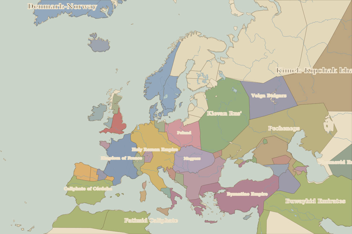
Map of Europe in 1000
This border map shows Europe and the Mediterranean in 1000 (era: High Middle Ages). The largest states within the map area were Buwayhid Emirates, Fatimid Caliphate and Kimek-Kipchak khaganate. The map stays in use until the next border change recorded in 1100.
Open Europe in 1000 in the interactive map
States on the map in 1000
Areas are approximate and count only territory inside the map area.
| State | Approx. area on map |
|---|---|
| Buwayhid Emirates | 2.00 million km² |
| Fatimid Caliphate | 1.77 million km² |
| Kimek-Kipchak khaganate | 1.42 million km² |
| Pechenegs | 1.37 million km² |
| Kievan Rus' | 1.20 million km² |
| Byzantine Empire | 840,000 km² |
| Denmark-Norway | 790,000 km² |
| Caliphate of Córdoba | 720,000 km² |
| Holy Roman Empire | 700,000 km² |
| Volga Bulgars | 630,000 km² |
| Kingdom of France | 490,000 km² |
| Ghaznavid Emirate | 420,000 km² |
| Bulgar Khanate | 370,000 km² |
| Magyars | 360,000 km² |
| Khazars | 340,000 km² |
| Poland | 330,000 km² |
| Sweden | 180,000 km² |
| Armenia | 150,000 km² |
| Makkura | 140,000 km² |
| England | 110,000 km² |
| León | 110,000 km² |
| Celtic kingdoms | 100,000 km² |
| Icelandic Commonwealth | 100,000 km² |
| Muscat | 80,000 km² |
| Alans | 70,000 km² |
Rulers in 1000
| Realm | Ruler | Reign |
|---|---|---|
| Byzantium | Basil II | 976–1025 |
| Franks / HRE / Germany | Otto III | 983–1002 |
| France | Robert II | 996–1031 |
| England / UK | Æthelred II | 978–1016 |
| Rus' / Russia | Volodymyr the Great | 980–1015 |
Key events, 1000 to 1099
| Year | Event | Where |
|---|---|---|
| 1030 | Battle of Stiklestad | Battle of Stiklestad |
| 1054 | East–West Schism | Istanbul |
| 1066 | Battle of Hastings; Norman Conquest | Battle of Hastings |
| 1071 | Battle of Manzikert | Battle of Manzikert |
| 1077 | The walk to Canossa | Canossa |
| 1095 | Council of Clermont calls the Crusade | Clermont |
| 1099 | Crusaders take Jerusalem | Jerusalem |
Battles and sites in this period
- Battle of Stiklestad · 1030
- Battle of Hastings · 1066
- Battle of Manzikert · 1071
- Canossa · 1077
- Clermont · 1095
← Europe in AD 900Europe in 1100 →
Part of the era: High Middle Ages.