Byzantine Empire: Map & Borders Over Time
Byzantine Empire appears on 7 of the 39 border maps, from AD 800 to 1400. Its mapped territory was largest in 1200, at roughly 850,000 km². Chronica Maps groups it with the Byzantium lineage, shown in the same colour across periods.
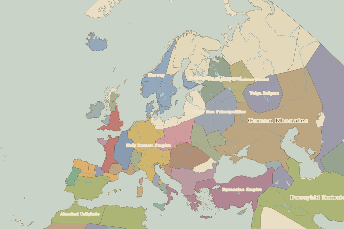
Open 1200 in the interactive map
Territory of Byzantine Empire over time
Approximate area on each border map.
| Map year | Approx. area | Change |
|---|---|---|
| AD 800 | 830,000 km² | – |
| AD 900 | 750,000 km² | -10% |
| 1000 | 840,000 km² | +13% |
| 1100 | 830,000 km² | -1% |
| 1200 | 850,000 km² | +2% |
| 1300 | 430,000 km² | -49% |
| 1400 | 130,000 km² | -70% |
Cities within Byzantine Empire in 1200
Rulers (Byzantium)
| Reign | Ruler |
|---|---|
| 797–802 | Empress Irene |
| 802–811 | Nikephoros I |
| 813–820 | Leo V |
| 820–842 | Michael II / Theophilos |
| 842–867 | Michael III |
| 867–886 | Basil I |
| 886–912 | Leo VI |
| 913–959 | Constantine VII |
| 959–976 | Romanos II / Nikephoros II / John I |
| 976–1025 | Basil II |
| 1025–1081 | Late Macedonian dynasty and turmoil |
| 1081–1118 | Alexios I |
| 1118–1143 | John II |
| 1143–1180 | Manuel I |
| 1180–1204 | Angelos emperors |
| 1204–1261 | Empire of Nicaea in exile (Latin Empire holds the capital) |
| 1261–1282 | Michael VIII |
| 1282–1328 | Andronikos II |
| 1328–1341 | Andronikos III |
| 1341–1391 | John V |
| 1391–1425 | Manuel II |
| 1425–1448 | John VIII |
| 1449–1453 | Constantine XI |