Map of Europe in AD 800
This border map shows Europe and the Mediterranean in AD 800 (era: Early Middle Ages). The largest states on the map were Abbasid Caliphate, Khazars and Carolingian Empire. The map stays in use until the next border change recorded in AD 900.
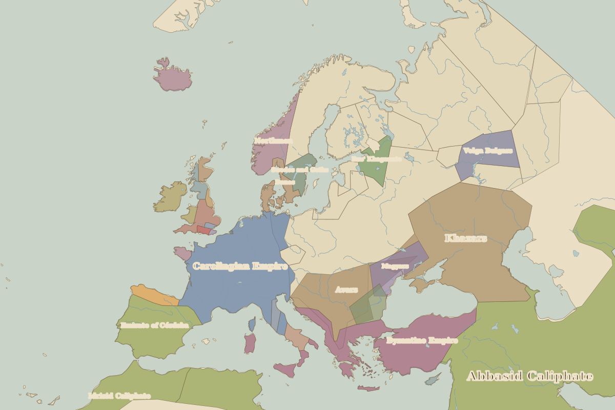
Open Europe in AD 800 in the interactive map
States on the map in AD 800
Areas are approximate and cover each state's whole territory, including land outside the map frame.
| State | Approx. area |
|---|---|
| Abbasid Caliphate | 8.40 million km² |
| Khazars | 1.56 million km² |
| Carolingian Empire | 1.19 million km² |
| Byzantine Empire | 830,000 km² |
| Aghlabid Emirate | 620,000 km² |
| Avars | 610,000 km² |
| Idrisid Caliphate | 580,000 km² |
| Emirate of Córdoba | 490,000 km² |
| Northmen | 320,000 km² |
| Volga Bulgars | 260,000 km² |
| Magyars | 210,000 km² |
| Bulgars | 130,000 km² |
| Rus' Khaganate | 120,000 km² |
| Danes | 100,000 km² |
| Swedes and Goths | 100,000 km² |
| Irish kingdoms | 80,000 km² |
| Mercia | 80,000 km² |
| Asturias | 70,000 km² |
| Lombard duchies | 50,000 km² |
| Picts | 30,000 km² |
| Papal States | 30,000 km² |
| Celtic kingdoms | 30,000 km² |
| Brittany | 20,000 km² |
| Welsh | 20,000 km² |
| Scots | 10,000 km² |
Rulers in AD 800
| Realm | Ruler | Reign |
|---|---|---|
| Byzantium | Empress Irene | 797–802 |
| Franks / HRE / Germany | Charlemagne | 768–814 |
Key events, AD 800 to AD 899
| Year | Event | Where |
|---|---|---|
| AD 800 | Charlemagne crowned emperor | Rome |
| AD 843 | Treaty of Verdun divides the Carolingian Empire | Battle of Verdun |
| AD 862 | Rurik comes to Novgorod | Novgorod |
| AD 874 | Settlement of Iceland begins | Reykjavík |
← Europe in AD 700Europe in AD 900 →
Part of the era: Early Middle Ages. See also the world in AD 800.