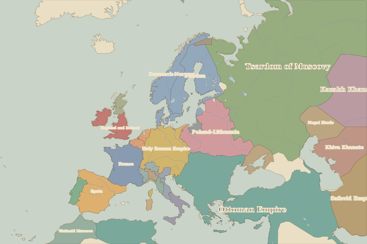
Map of Europe in 1600
This border map shows Europe and the Mediterranean in 1600 (era: Renaissance & Reformation). The largest states on the map were Tsardom of Muscovy, Ottoman Empire and Kazakh Khanate. The map stays in use until the next border change recorded in 1650.
Open Europe in 1600 in the interactive map
States on the map in 1600
Areas are approximate and cover each state's whole territory, including land outside the map frame.
| State | Approx. area |
|---|---|
| Tsardom of Muscovy | 6.85 million km² |
| Ottoman Empire | 5.27 million km² |
| Kazakh Khanate | 1.96 million km² |
| Safavid Empire | 1.61 million km² |
| Khiva Khanate | 940,000 km² |
| Poland-Lithuania | 890,000 km² |
| Sweden | 680,000 km² |
| Holy Roman Empire | 670,000 km² |
| Denmark-Norway | 500,000 km² |
| Spain | 490,000 km² |
| France | 480,000 km² |
| Nogai Horde | 370,000 km² |
| Wattasid Morocco | 360,000 km² |
| England and Ireland | 220,000 km² |
| Crimean Khanate | 170,000 km² |
| Portugal | 90,000 km² |
| Naples | 70,000 km² |
| Scotland | 60,000 km² |
| Habsburg Netherlands | 40,000 km² |
| Prussia | 40,000 km² |
| Papal States | 40,000 km² |
| Venice | 40,000 km² |
| Swiss Confederation | 40,000 km² |
| Florence | 40,000 km² |
| Dutch Republic | 30,000 km² |
Rulers in 1600
| Realm | Ruler | Reign |
|---|---|---|
| Franks / HRE / Germany | Rudolf II | 1576–1612 |
| France | Henry IV | 1589–1610 |
| England / UK | Elizabeth I | 1558–1603 |
| Spain | Philip III | 1598–1621 |
| Rus' / Russia | Boris Godunov | 1598–1605 |
Key events, 1600 to 1649
| Year | Event | Where |
|---|---|---|
| 1618 | Defenestration of Prague; Thirty Years' War begins | Prague |
| 1632 | Battle of Lützen; Gustavus Adolphus killed | Battle of Lützen |
| 1648 | Peace of Westphalia | Münster |
Battles and sites in this period
- Battle of the White Mountain · 1620
- Battle of Lützen · 1632
- Münster · 1648
← Europe in 1500Europe in 1650 →
Part of the era: Renaissance & Reformation. See also the world in 1600.