End of the Cold War: Europe in 1960 and 1994
The Soviet Union and Yugoslavia break apart and Germany reunites. Between 1960 and 1994, 17 states appear on the map of Europe and 5 disappear. Among those that vanish: Yugoslavia, West Germany, Czechoslovakia. New on the map: Ukraine, Germany, Belarus.
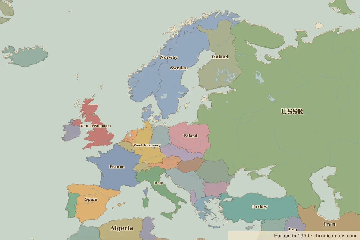
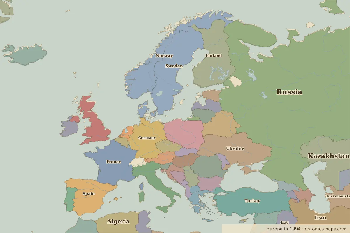
Open 1994 in the interactive map
States that disappeared
| State | Area in 1960 |
|---|---|
| Yugoslavia | 250,000 km² |
| West Germany | 240,000 km² |
| Czechoslovakia | 130,000 km² |
| East Germany | 110,000 km² |
| Switzerland | 40,000 km² |
New states on the map
| State | Area in 1994 |
|---|---|
| Ukraine | 590,000 km² |
| Germany | 350,000 km² |
| Belarus | 210,000 km² |
| Serbia | 90,000 km² |
| Azerbaijan | 90,000 km² |
| Czech Republic | 80,000 km² |
| Georgia | 70,000 km² |
| Lithuania | 60,000 km² |
| Latvia | 60,000 km² |
| Croatia | 50,000 km² |
| Bosnia and Herzegovina | 50,000 km² |
| Slovakia | 50,000 km² |
What happened in between
| Year | Event | Where |
|---|---|---|
| 1961 | Berlin Wall built | Berlin |
| 1968 | Prague Spring | Prague |
| 1979 | The Iranian Revolution | Tehran |
| 1986 | Chernobyl disaster | Chernobyl |
| 1989 | Fall of the Berlin Wall | Berlin |
| 1990 | Baltic states declare restored independence | Vilnius |
| 1991 | Dissolution of the Soviet Union | Moscow |
| 1992 | Maastricht Treaty | Maastricht |
Battles of the period
- Chernobyl · 1986
- Maastricht · 1992
People of the period
| Lived | Person | |
|---|---|---|
| 1874 – 1965 | Winston Churchill | British prime minister |
| 1890 – 1970 | Charles de Gaulle | President of France |
| 1918 – 1970 | Gamal Abdel Nasser | President of Egypt |
Questions
How did the map of Europe change between 1960 and 1994?
Between 1960 and 1994, 17 states appear on the map of Europe and 5 disappear. Among those that vanish: Yugoslavia, West Germany, Czechoslovakia. New on the map: Ukraine, Germany, Belarus.
Which states disappeared from the map of Europe between 1960 and 1994?
Yugoslavia, West Germany, Czechoslovakia, East Germany, Switzerland.
Which new states appeared between 1960 and 1994?
Ukraine, Germany, Belarus, Serbia, Azerbaijan, Czech Republic, Georgia, Lithuania, Latvia, Croatia.
Borders are drawn from the nearest available maps and are approximate.
Last updated 10 November 2026. Sources: border data from historical-basemaps, land and rivers from Natural Earth; texts written for Chronica Maps from standard reference works. How we make the maps.