How World War I Redrew the Map of Europe
Published 9 November 2026
Four empires fell in World War I and a belt of new states appeared from Finland to Yugoslavia. Compare Europe in 1914 and 1920.
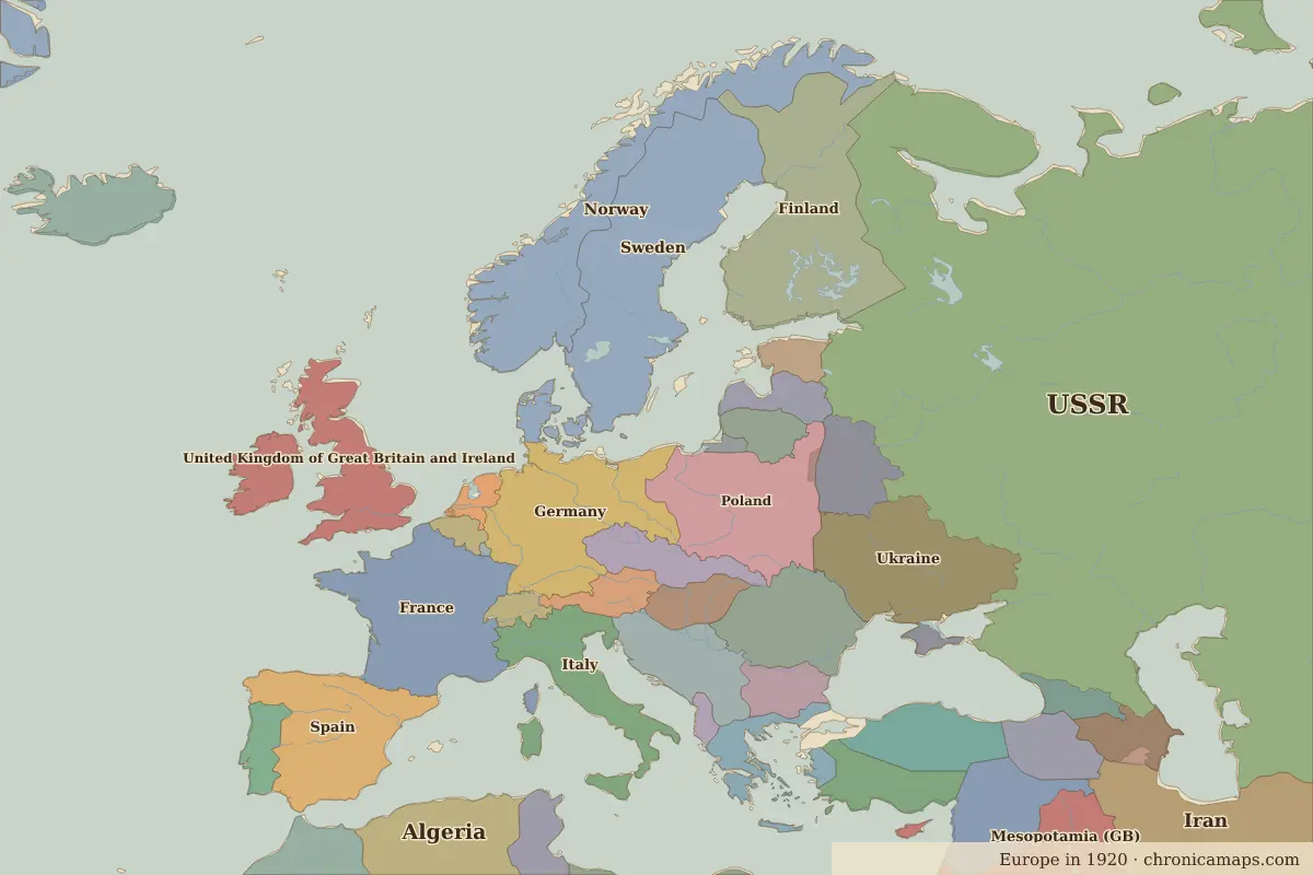
The armistice of 11 November 1918 ended the fighting on the Western Front. By then four empires had collapsed or were collapsing: the German, Austro-Hungarian, Russian and Ottoman empires.
The peace treaties of 1919 and 1920 — Versailles, Saint-Germain, Trianon and Sèvres — and the wars that followed created or restored a row of states: Finland, Estonia, Latvia, Lithuania, Poland, Czechoslovakia, Austria, Hungary and the Kingdom of Serbs, Croats and Slovenes (later Yugoslavia).
Drag the slider in the 1914 vs 1920 comparison to see the change, or read about Europe in 1914 and Europe in 1920.
Open 1920 in the interactive map
Related
Last updated 9 November 2026. Sources: border data from historical-basemaps, land and rivers from Natural Earth; texts written for Chronica Maps from standard reference works. How we make the maps.