Map of Europe in 1920
This border map shows Europe and the Mediterranean in 1920 (era: The World Wars). The largest states on the map were USSR, Algeria and Denmark. The map stays in use until the next border change recorded in 1930.
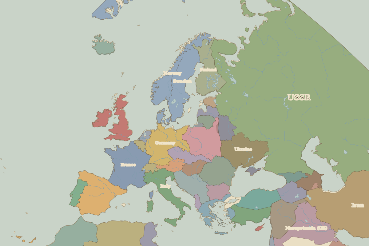
Open Europe in 1920 in the interactive map
States on the map in 1920
Areas are approximate and cover each state's whole territory, including land outside the map frame.
| State | Approx. area |
|---|---|
| USSR | 21.36 million km² |
| Algeria | 2.31 million km² |
| Denmark | 2.13 million km² |
| Iran | 1.59 million km² |
| Emirate of Bin Shal'an | 1.14 million km² |
| France | 550,000 km² |
| Mesopotamia (GB) | 550,000 km² |
| Italy | 510,000 km² |
| Spain | 490,000 km² |
| Sweden | 430,000 km² |
| Ukraine | 430,000 km² |
| Germany | 430,000 km² |
| Morocco | 410,000 km² |
| Poland | 390,000 km² |
| Finland | 370,000 km² |
| Norway | 350,000 km² |
| Syria (France) | 320,000 km² |
| Romania | 300,000 km² |
| United Kingdom of Great Britain and Ireland | 300,000 km² |
| Ottoman Sultanate | 250,000 km² |
| Yugoslavia | 240,000 km² |
| Armenia | 160,000 km² |
| Tunisia | 160,000 km² |
| Greece | 150,000 km² |
| Czechoslovakia | 140,000 km² |
Rulers in 1920
| Realm | Ruler | Reign |
|---|---|---|
| Franks / HRE / Germany | Ebert (Weimar president) | 1919–1925 |
| France | Third Republic | 1870–1940 |
| England / UK | George V | 1910–1936 |
| Rus' / Russia | Lenin | 1917–1924 |
| Ottomans / Turkey | Mehmed VI | 1918–1922 |
Key events, 1920 to 1929
← Europe in 1914Europe in 1930 →
Part of the era: The World Wars. See also the world in 1920.