The Fall of the Berlin Wall and Europe's New Map
Published 9 November 2026
On 9 November 1989 the Berlin Wall opened. Within four years the map of Europe was redrawn: see the borders before and after.
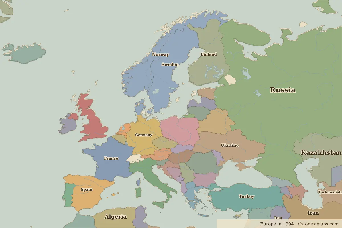
On the night of 9 November 1989 the border crossings in the Berlin Wall opened, after 28 years in which the wall had divided the city. The event became the symbol of the end of the Cold War in Europe.
The map changed quickly afterwards. Germany was reunified on 3 October 1990. The Soviet Union dissolved in December 1991 into fifteen states, among them Russia, Ukraine, Belarus and the three Baltic states. Yugoslavia broke apart from 1991, and Czechoslovakia split peacefully into the Czech Republic and Slovakia on 1 January 1993.
Compare the two border maps directly with the Cold War comparison, or open Europe in 1994 and Europe in 1960.
Open 1994 in the interactive map
Related
Last updated 9 November 2026. Sources: border data from historical-basemaps, land and rivers from Natural Earth; texts written for Chronica Maps from standard reference works. How we make the maps.