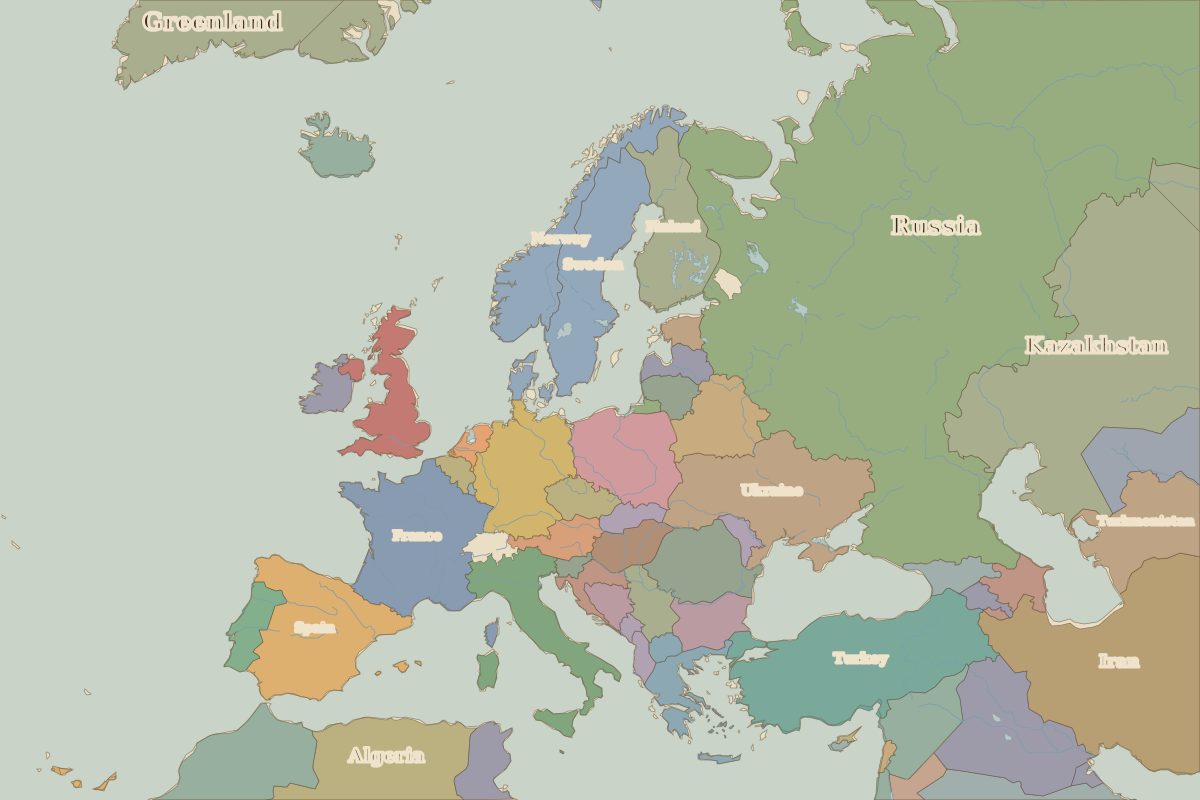
Map of Europe in 1994
This border map shows Europe and the Mediterranean in 1994 (era: Contemporary Europe). The largest states within the map area were Russia, Algeria and Kazakhstan. The map stays in use until the next border change recorded in 2010.
Open Europe in 1994 in the interactive map
States on the map in 1994
Areas are approximate and count only territory inside the map area.
| State | Approx. area on map |
|---|---|
| Russia | 5.21 million km² |
| Algeria | 2.12 million km² |
| Kazakhstan | 2.05 million km² |
| Iran | 1.59 million km² |
| Libya | 1.52 million km² |
| Saudi Arabia | 1.19 million km² |
| Egypt | 980,000 km² |
| Turkey | 790,000 km² |
| Ukraine | 590,000 km² |
| France | 550,000 km² |
| Spain | 500,000 km² |
| Iraq | 440,000 km² |
| Sweden | 430,000 km² |
| Greenland | 420,000 km² |
| Morocco | 410,000 km² |
| Uzbekistan | 360,000 km² |
| Turkmenistan | 360,000 km² |
| Germany | 350,000 km² |
| Norway | 350,000 km² |
| Finland | 330,000 km² |
| Poland | 310,000 km² |
| Italy | 300,000 km² |
| Western Sahara | 230,000 km² |
| Romania | 230,000 km² |
| United Kingdom | 220,000 km² |
Rulers in 1994
| Realm | Ruler | Reign |
|---|---|---|
| Franks / HRE / Germany | Kohl (chancellor) | 1982–1998 |
| France | Mitterrand | 1981–1995 |
| England / UK | Elizabeth II | 1952–2022 |
| Spain | Juan Carlos I | 1975–2014 |
| Rus' / Russia | Yeltsin | 1991–1999 |
Key events, 1994 to 2009
| Year | Event | Where |
|---|---|---|
| 2002 | Euro notes and coins introduced | |
| 2004 | EU enlarges by ten states | Brussels |
← Europe in 1960Europe in 2010 →
Part of the era: Contemporary Europe.