Map of Europe in 1960
This border map shows Europe and the Mediterranean in 1960 (era: The Cold War). The largest states on the map were USSR, Algeria and Greenland. The map stays in use until the next border change recorded in 1994.
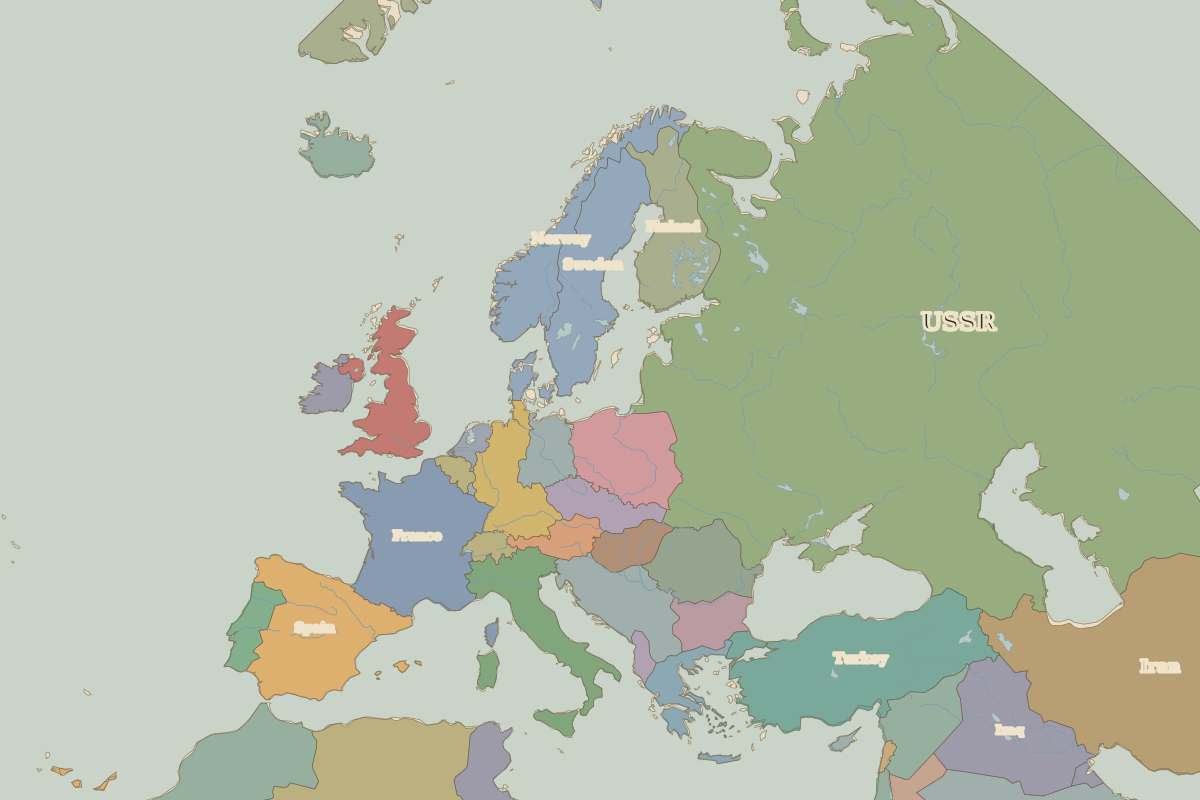
Open Europe in 1960 in the interactive map
States on the map in 1960
Areas are approximate and cover each state's whole territory, including land outside the map frame.
| State | Approx. area |
|---|---|
| USSR | 21.75 million km² |
| Algeria | 2.31 million km² |
| Greenland | 2.09 million km² |
| Saudi Arabia | 1.92 million km² |
| Iran | 1.61 million km² |
| Turkey | 790,000 km² |
| France | 550,000 km² |
| Spain | 500,000 km² |
| Iraq | 440,000 km² |
| Sweden | 430,000 km² |
| Morocco | 410,000 km² |
| Norway | 350,000 km² |
| Finland | 330,000 km² |
| Poland | 310,000 km² |
| Italy | 300,000 km² |
| Yugoslavia | 250,000 km² |
| West Germany | 240,000 km² |
| Romania | 230,000 km² |
| United Kingdom | 220,000 km² |
| Syria | 190,000 km² |
| Tunisia | 160,000 km² |
| Czechoslovakia | 130,000 km² |
| Bulgaria | 120,000 km² |
| East Germany | 110,000 km² |
| Greece | 110,000 km² |
Rulers in 1960
| Realm | Ruler | Reign |
|---|---|---|
| Franks / HRE / Germany | Adenauer (W. German chancellor) | 1949–1963 |
| France | de Gaulle | 1959–1969 |
| England / UK | Elizabeth II | 1952–2022 |
| Spain | Franco | 1939–1975 |
| Rus' / Russia | Khrushchev | 1953–1964 |
Key events, 1960 to 1993
| Year | Event | Where |
|---|---|---|
| 1961 | Berlin Wall built | Berlin |
| 1968 | Prague Spring | Prague |
| 1986 | Chernobyl disaster | Chernobyl |
| 1989 | Fall of the Berlin Wall | Berlin |
| 1990 | Baltic states declare restored independence | Vilnius |
| 1991 | Dissolution of the Soviet Union | Moscow |
| 1992 | Maastricht Treaty | Maastricht |
Battles and sites in this period
- Chernobyl · 1986
- Maastricht · 1992
← Europe in 1945Europe in 1994 →
Part of the era: The Cold War. See also the world in 1960.