Map of Europe in 1945
This border map shows Europe and the Mediterranean in 1945 (era: The Cold War). The largest states on the map were USSR, Algeria and Denmark. The map stays in use until the next border change recorded in 1960.
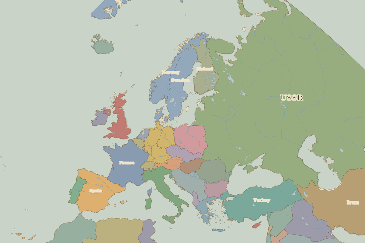
Open Europe in 1945 in the interactive map
States on the map in 1945
Areas are approximate and cover each state's whole territory, including land outside the map frame.
| State | Approx. area |
|---|---|
| USSR | 21.76 million km² |
| Algeria | 2.31 million km² |
| Denmark | 2.12 million km² |
| Saudi Arabia | 1.92 million km² |
| Iran | 1.61 million km² |
| Turkey | 790,000 km² |
| France | 550,000 km² |
| Spain | 500,000 km² |
| Iraq | 440,000 km² |
| Sweden | 430,000 km² |
| Morocco | 410,000 km² |
| Norway | 350,000 km² |
| Finland | 330,000 km² |
| Italy | 310,000 km² |
| Poland | 310,000 km² |
| Yugoslavia | 240,000 km² |
| Romania | 230,000 km² |
| United Kingdom | 230,000 km² |
| Syria | 190,000 km² |
| Tunisia | 160,000 km² |
| Czechoslovakia | 130,000 km² |
| Bulgaria | 120,000 km² |
| Germany (Soviet) | 110,000 km² |
| Greece | 110,000 km² |
| Germany (USA) | 100,000 km² |
Rulers in 1945
| Realm | Ruler | Reign |
|---|---|---|
| Franks / HRE / Germany | Hitler | 1933–1945 |
| France | Provisional Government and Fourth Republic | 1944–1958 |
| England / UK | Edward VIII / George VI | 1936–1952 |
| Spain | Franco | 1939–1975 |
| Rus' / Russia | Stalin | 1924–1953 |
Key events, 1945 to 1959
| Year | Event | Where |
|---|---|---|
| 1945 | War in Europe ends | Berlin |
| 1949 | NATO founded; Germany divided | Berlin |
| 1957 | Treaty of Rome | Rome |
Battles and sites in this period
- Yalta · 1945
← Europe in 1938Europe in 1960 →
Part of the era: The Cold War. See also the world in 1945.