World Map in 1400
This world map shows state borders in 1400. The largest states and empires were Great Khanate, Timurid Empire, White Horde, Sultanate of Delhi and Kalmar Union. The map stays in use until the next recorded border change in 1492.
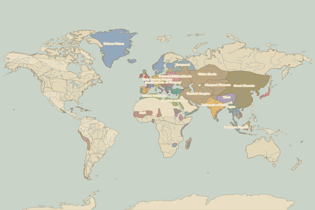
Open the world in 1400 in the interactive map
Largest states and empires in 1400
Areas are approximate, from the historical border data.
| State | Approx. area | Region |
|---|---|---|
| Great Khanate | 10.55 million km² | Asia |
| Timurid Empire | 5.09 million km² | Asia |
| White Horde | 3.72 million km² | Asia |
| Sultanate of Delhi | 2.94 million km² | Asia |
| Kalmar Union | 2.82 million km² | Europe |
| Chagatai Khanate | 2.17 million km² | Asia |
| Blue Horde | 1.83 million km² | Europe |
| Tibet | 1.79 million km² | Asia |
| Mali | 1.57 million km² | Africa |
| Mamluk Sultanate | 1.24 million km² | Africa |
| Holy Roman Empire | 920,000 km² | Europe |
| Poland-Lithuania | 910,000 km² | Europe |
| Novgorod | 880,000 km² | Europe |
| Pagan | 730,000 km² | Asia |
| Hafsid Caliphate | 680,000 km² | Europe |
| Srivijaya Empire | 640,000 km² | Asia |
| Madagascar | 430,000 km² | Africa |
| Andean states and chiefdoms | 430,000 km² | – |
| Makkura | 400,000 km² | Africa |
| Kingdom of Hungary | 400,000 km² | Europe |
| France | 390,000 km² | Europe |
| Ottoman Empire | 390,000 km² | Europe |
| Aymara kingdoms | 390,000 km² | – |
| Kanem-Bornu | 370,000 km² | Africa |
| minor Hindu and Buddhist kingdoms | 350,000 km² | Asia |
| Ethiopia | 350,000 km² | Africa |
| Islamic city-states | 340,000 km² | Africa |
| Castile | 320,000 km² | Europe |
| Hadramaut | 310,000 km² | Africa |
| English territory | 290,000 km² | Europe |
Regional maps
- Europe in 1400 (map image) · open in the interactive map
- Asia in 1400 (map image) · open in the interactive map
- Africa in 1400 (map image) · open in the interactive map
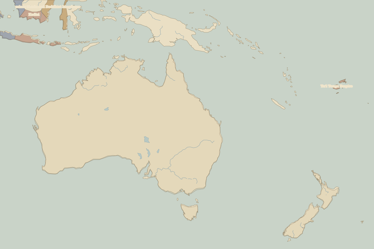
- Oceania in 1400 (map image) · open in the interactive map
- Europe in 1400: rulers and events
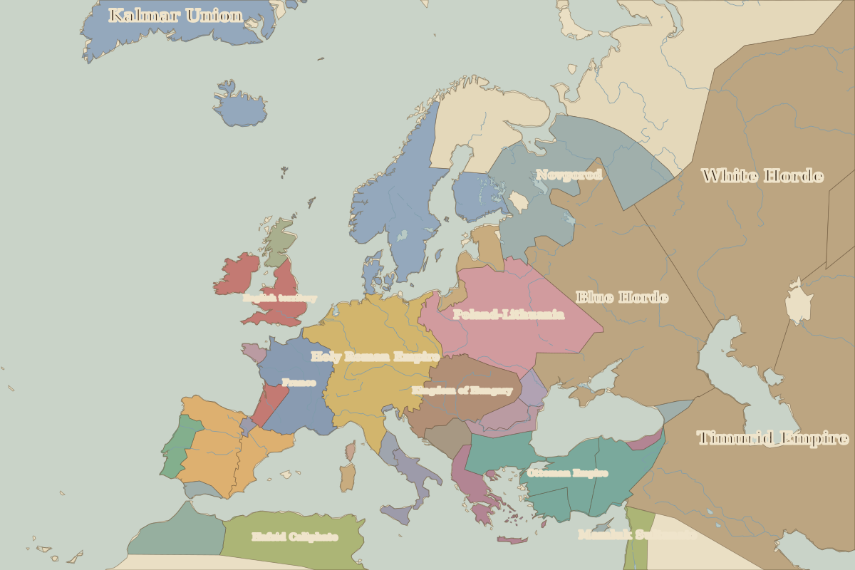
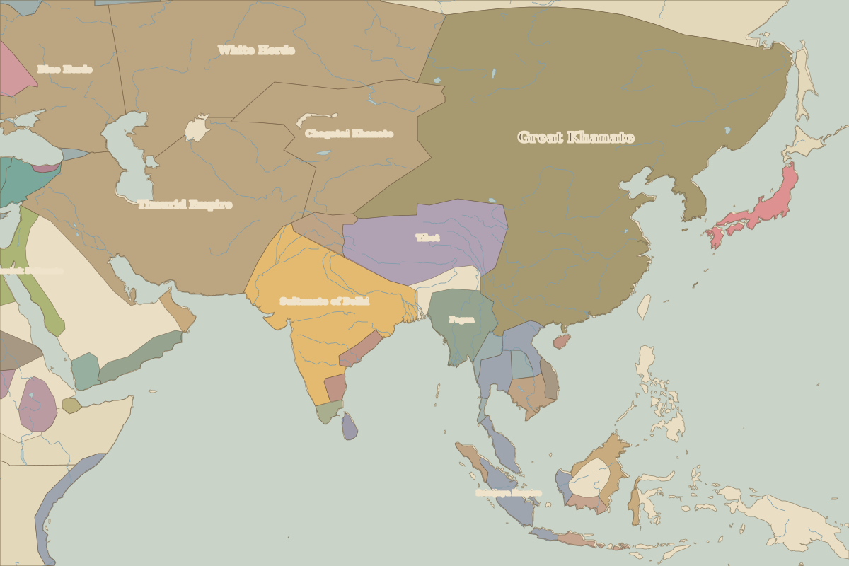
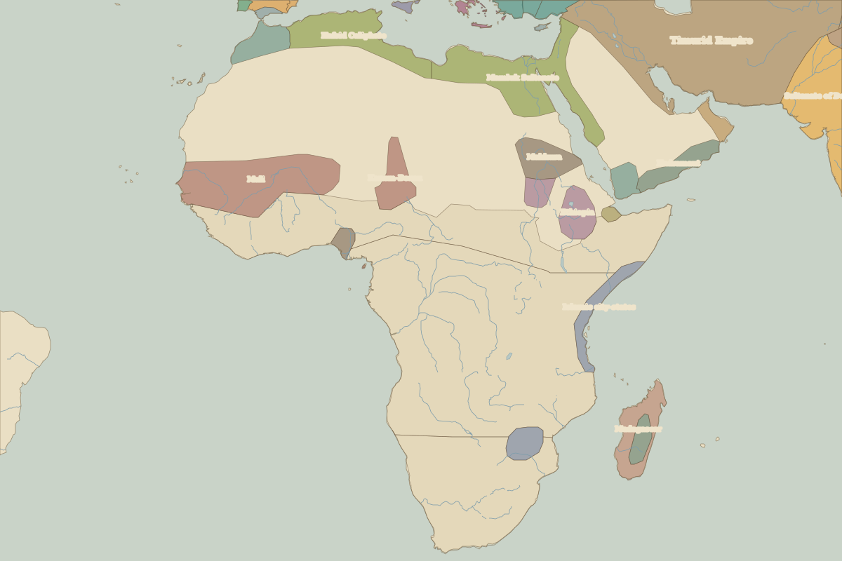
Key events, 1400 to 1491
| Year | Event | Where |
|---|---|---|
| 1402 | Battle of Ankara | Battle of Ankara |
| 1405 | Zheng He's first voyage | Nanjing |
| 1410 | Battle of Grunwald | Battle of Grunwald |
| 1415 | Battle of Agincourt | Battle of Agincourt |
| 1429 | Joan of Arc relieves Orléans | Battle of Orléans |
| 1444 | Battle of Varna | Battle of Varna |
| 1449 | The Tumu Crisis | Battle of Tumu Fortress |
| 1453 | Fall of Constantinople | Istanbul |
| 1455 | Gutenberg prints the Bible | |
| 1480 | Moscow throws off the Golden Horde | Moscow |
Battles and sites in this period
- Battle of Ankara · 1402
- Battle of Grunwald · 1410
- Battle of Agincourt · 1415
- Battle of Orléans · 1429
- Battle of Varna · 1444
- Battle of Tumu Fortress · 1449