Asia in the age of imperialism: Asia in 1800 and 1900
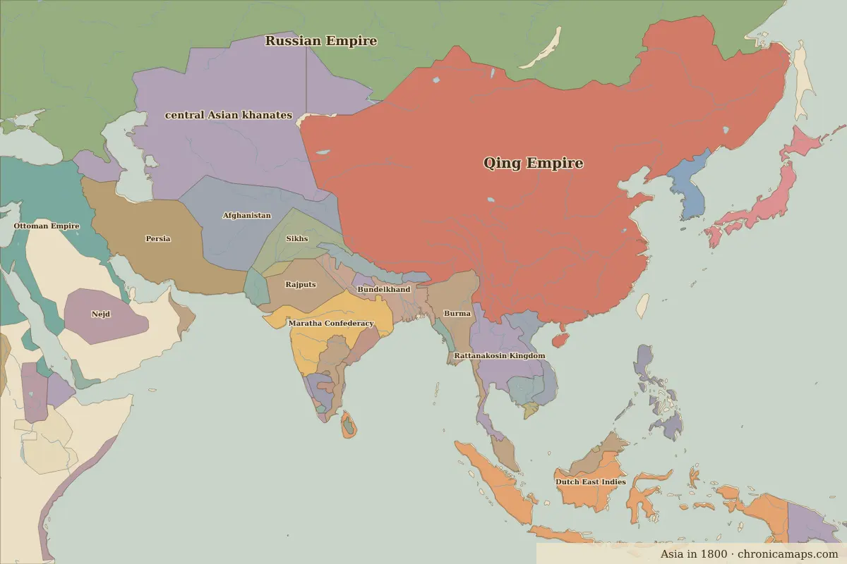
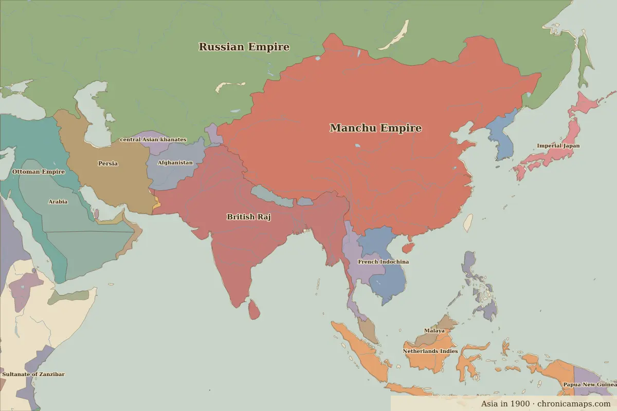
Between 1800 and 1900, 7 states appear on the map of Asia and 22 disappear. Among those that vanish: Qing Empire, Dutch East Indies, Maratha Confederacy. New on the map: Manchu Empire, British Raj, Netherlands Indies. central Asian khanates loses the most territory.
Open 1900 in the interactive map
States that disappeared
| State | Area in 1800 |
|---|---|
| Qing Empire | 12.21 million km² |
| Dutch East Indies | 1.70 million km² |
| Maratha Confederacy | 1.02 million km² |
| Burma | 650,000 km² |
| Rajputs | 560,000 km² |
| Sikhs | 530,000 km² |
| Bundelkhand | 510,000 km² |
| Japan | 370,000 km² |
| Đại Việt | 290,000 km² |
| Nizam's Dominions | 190,000 km² |
| Cambodia | 180,000 km² |
| Sindh | 130,000 km² |
New states on the map
| State | Area in 1900 |
|---|---|
| Manchu Empire | 11.02 million km² |
| British Raj | 4.71 million km² |
| Netherlands Indies | 1.70 million km² |
| French Indochina | 740,000 km² |
| Imperial Japan | 370,000 km² |
| Ceylon | 60,000 km² |
| Trucial Oman | 50,000 km² |
States that grew or shrank
| State | Change in area |
|---|---|
| central Asian khanates | −3.23 million km² |
| Afghanistan | −660,000 km² |
| Rattanakosin Kingdom | −230,000 km² |
| Nepal | −60,000 km² |
| Oman | +20,000 km² |
What happened in between
| Year | Event | Where |
|---|---|---|
| 1840 | The First Opium War begins | Guangzhou |
| 1851 | The Taiping Rebellion begins | |
| 1857 | The Indian Rebellion | Delhi |
| 1868 | The Meiji Restoration | Tokyo |
| 1895 | End of the First Sino-Japanese War; Taiwan is ceded | Battle of Weihaiwei |
Battles of the period
- Battle of Weihaiwei · 1895
People of the period
| Lived | Person | |
|---|---|---|
| 1780 – 1839 | Ranjit Singh | Maharaja of the Sikh Empire |
| 1781 – 1826 | Stamford Raffles | British colonial official |
| 1785 – 1850 | Lin Zexu | Qing official |
| 1835 – 1908 | Empress Dowager Cixi | De facto ruler of Qing China |
| 1853 – 1910 | Chulalongkorn (Rama V) | King of Siam |
| 1861 – 1941 | Rabindranath Tagore | Poet |
| 1861 – 1896 | José Rizal | Filipino national hero |
| 1869 – 1948 | Mahatma Gandhi | Leader of Indian independence |
| 1876 – 1948 | Muhammad Ali Jinnah | Founder of Pakistan |
| 1889 – 1964 | Jawaharlal Nehru | First prime minister of India |
Questions
How did the map of Asia change between 1800 and 1900?
Between 1800 and 1900, 7 states appear on the map of Asia and 22 disappear. Among those that vanish: Qing Empire, Dutch East Indies, Maratha Confederacy. New on the map: Manchu Empire, British Raj, Netherlands Indies. central Asian khanates loses the most territory.
Which states disappeared from the map of Asia between 1800 and 1900?
Qing Empire, Dutch East Indies, Maratha Confederacy, Burma, Rajputs, Sikhs, Bundelkhand, Japan, Đại Việt, Nizam's Dominions.
Which new states appeared between 1800 and 1900?
Manchu Empire, British Raj, Netherlands Indies, French Indochina, Imperial Japan, Ceylon, Trucial Oman.
Borders are drawn from the nearest available maps and are approximate.
Last updated 10 November 2026. Sources: border data from historical-basemaps, land and rivers from Natural Earth; texts written for Chronica Maps from standard reference works. How we make the maps.