Map of Europe in 1815
This border map shows Europe and the Mediterranean in 1815 (era: Century of Nation-States). The largest states within the map area were Russian Empire, Ottoman Empire and Persia. The map stays in use until the next border change recorded in 1880.
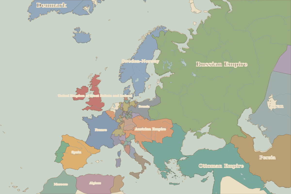
Open Europe in 1815 in the interactive map
States on the map in 1815
Areas are approximate and count only territory inside the map area.
| State | Approx. area on map |
|---|---|
| Russian Empire | 7.41 million km² |
| Ottoman Empire | 2.21 million km² |
| Persia | 1.77 million km² |
| Turan | 1.63 million km² |
| Sweden–Norway | 780,000 km² |
| Egypt | 690,000 km² |
| Austrian Empire | 600,000 km² |
| Denmark | 560,000 km² |
| France | 540,000 km² |
| Morocco | 500,000 km² |
| Spain | 490,000 km² |
| Algiers | 430,000 km² |
| Nejd | 330,000 km² |
| United Kingdom of Great Britain and Ireland | 290,000 km² |
| central Asian khanates | 290,000 km² |
| Prussia | 260,000 km² |
| Tunis | 100,000 km² |
| Portugal | 90,000 km² |
| Kingdom of the Two Sicilies | 90,000 km² |
| Bavaria | 80,000 km² |
| Tripolitania | 70,000 km² |
| Kingdom of Sardinia | 70,000 km² |
| Afghanistan | 60,000 km² |
| Cyrenaica | 50,000 km² |
| Oman | 50,000 km² |
Rulers in 1815
| Realm | Ruler | Reign |
|---|---|---|
| France | Louis XVIII | 1814–1824 |
| England / UK | George III | 1760–1820 |
| Rus' / Russia | Alexander I | 1801–1825 |
| Ottomans / Turkey | Mahmud II | 1808–1839 |
Key events, 1815 to 1879
| Year | Event | Where |
|---|---|---|
| 1815 | Waterloo; Congress of Vienna | Battle of Waterloo |
| 1827 | Battle of Navarino | Battle of Navarino |
| 1830 | Belgian independence | Brussels |
| 1848 | The “Springtime of Nations” | |
| 1853 | Crimean War | |
| 1861 | Kingdom of Italy proclaimed | |
| 1871 | German Empire proclaimed | Versailles |
| 1878 | Congress of Berlin | Berlin |
Battles and sites in this period
- Battle of Waterloo · 1815
- Battle of Navarino · 1827
- Battle of Sedan · 1870
← Europe in 1800Europe in 1880 →
Part of the era: Century of Nation-States.