Map of Europe in 1880
This border map shows Europe and the Mediterranean in 1880 (era: Century of Nation-States). The largest states within the map area were Russian Empire, Ottoman Empire and Persia. The map stays in use until the next border change recorded in 1900.
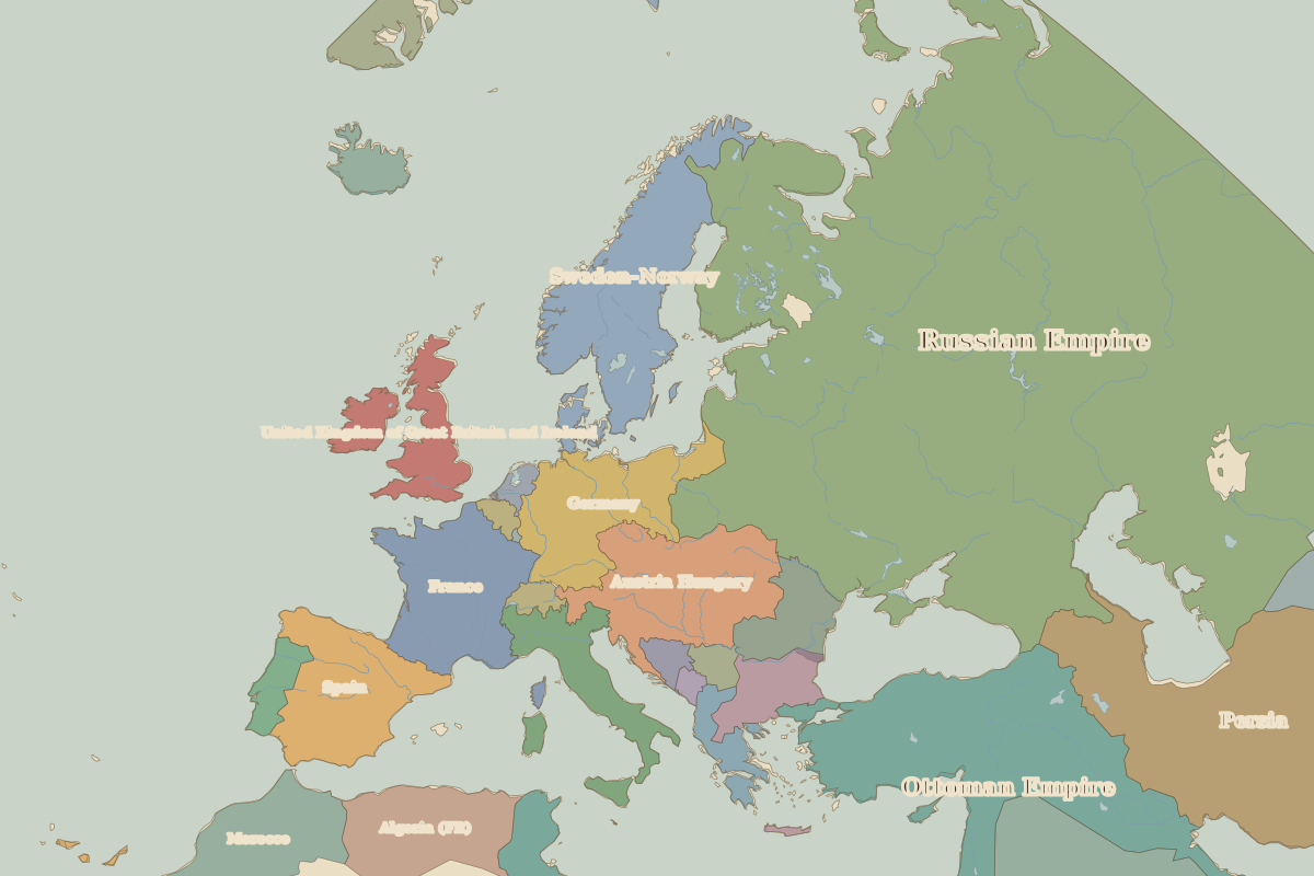
Open Europe in 1880 in the interactive map
States on the map in 1880
Areas are approximate and count only territory inside the map area.
| State | Approx. area on map |
|---|---|
| Russian Empire | 9.24 million km² |
| Ottoman Empire | 2.88 million km² |
| Persia | 1.76 million km² |
| Arabia | 1.22 million km² |
| Egypt | 900,000 km² |
| Sweden–Norway | 780,000 km² |
| Austria Hungary | 600,000 km² |
| France | 540,000 km² |
| Germany | 500,000 km² |
| Spain | 490,000 km² |
| Greenland | 420,000 km² |
| Algeria (FR) | 420,000 km² |
| Morocco | 410,000 km² |
| Italy | 300,000 km² |
| United Kingdom of Great Britain and Ireland | 290,000 km² |
| Romania | 200,000 km² |
| Bulgaria | 180,000 km² |
| Greece | 110,000 km² |
| Iceland | 100,000 km² |
| Portugal | 90,000 km² |
| Bokhara Khanate | 90,000 km² |
| Afghanistan | 60,000 km² |
| Trucial Oman | 50,000 km² |
| Serbia | 50,000 km² |
| Bosnia-Herzegovina | 50,000 km² |
Rulers in 1880
| Realm | Ruler | Reign |
|---|---|---|
| Franks / HRE / Germany | Kaiser Wilhelm I | 1871–1888 |
| France | Third Republic | 1870–1940 |
| England / UK | Queen Victoria | 1837–1901 |
| Rus' / Russia | Alexander II | 1855–1881 |
| Ottomans / Turkey | Abdul Hamid II | 1876–1909 |
← Europe in 1815Europe in 1900 →
Part of the era: Century of Nation-States.