The Americas from 1880 to 1920: Americas in 1880 and 1920
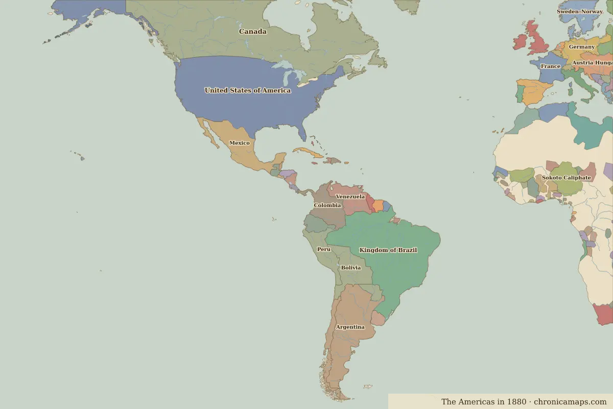
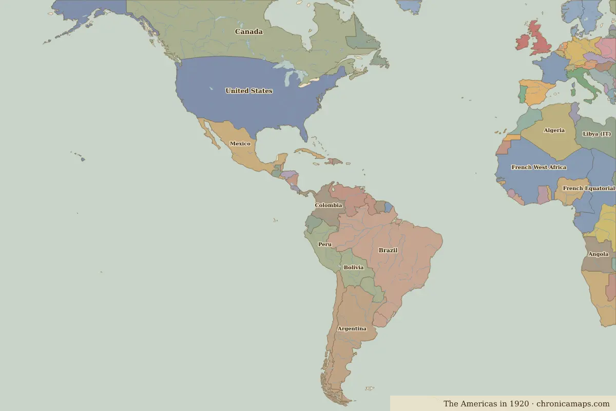
Between 1880 and 1920, 7 states appear on the map of Americas and 4 disappear. Among those that vanish: United States of America, Kingdom of Brazil, Dutch Guiana. New on the map: United States, Brazil, Dominion of Newfoundland. Bolivia loses the most territory.
Open 1920 in the interactive map
States that disappeared
| State | Area in 1880 |
|---|---|
| United States of America | 9.36 million km² |
| Kingdom of Brazil | 8.03 million km² |
| Dutch Guiana | 150,000 km² |
| British Guiana | 120,000 km² |
New states on the map
| State | Area in 1920 |
|---|---|
| United States | 9.38 million km² |
| Brazil | 8.42 million km² |
| Dominion of Newfoundland | 380,000 km² |
| Guyana | 210,000 km² |
| Suriname | 150,000 km² |
| Cuba | 100,000 km² |
| Panama | 70,000 km² |
States that grew or shrank
| State | Change in area |
|---|---|
| Bolivia | −390,000 km² |
| Chile | +340,000 km² |
| Colombia | −240,000 km² |
| Venezuela | −230,000 km² |
| Ecuador | −220,000 km² |
| Peru | +190,000 km² |
| Paraguay | +130,000 km² |
What happened in between
| Year | Event | Where |
|---|---|---|
| 1910 | The Mexican Revolution | Mexico City |
| 1914 | The Panama Canal opens | Panama Canal |
Battles of the period
- Panama Canal · 1914
People of the period
| Lived | Person | |
|---|---|---|
| 1825 – 1891 | Pedro II of Brazil | Emperor of Brazil |
| 1853 – 1895 | José Martí | Cuban poet and independence leader |
Questions
How did the map of Americas change between 1880 and 1920?
Between 1880 and 1920, 7 states appear on the map of Americas and 4 disappear. Among those that vanish: United States of America, Kingdom of Brazil, Dutch Guiana. New on the map: United States, Brazil, Dominion of Newfoundland. Bolivia loses the most territory.
Which states disappeared from the map of Americas between 1880 and 1920?
United States of America, Kingdom of Brazil, Dutch Guiana, British Guiana.
Which new states appeared between 1880 and 1920?
United States, Brazil, Dominion of Newfoundland, Guyana, Suriname, Cuba, Panama.
Borders are drawn from the nearest available maps and are approximate.
Last updated 10 November 2026. Sources: border data from historical-basemaps, land and rivers from Natural Earth; texts written for Chronica Maps from standard reference works. How we make the maps.