From the Yuan to the Ming: Asia in 1300 and 1400
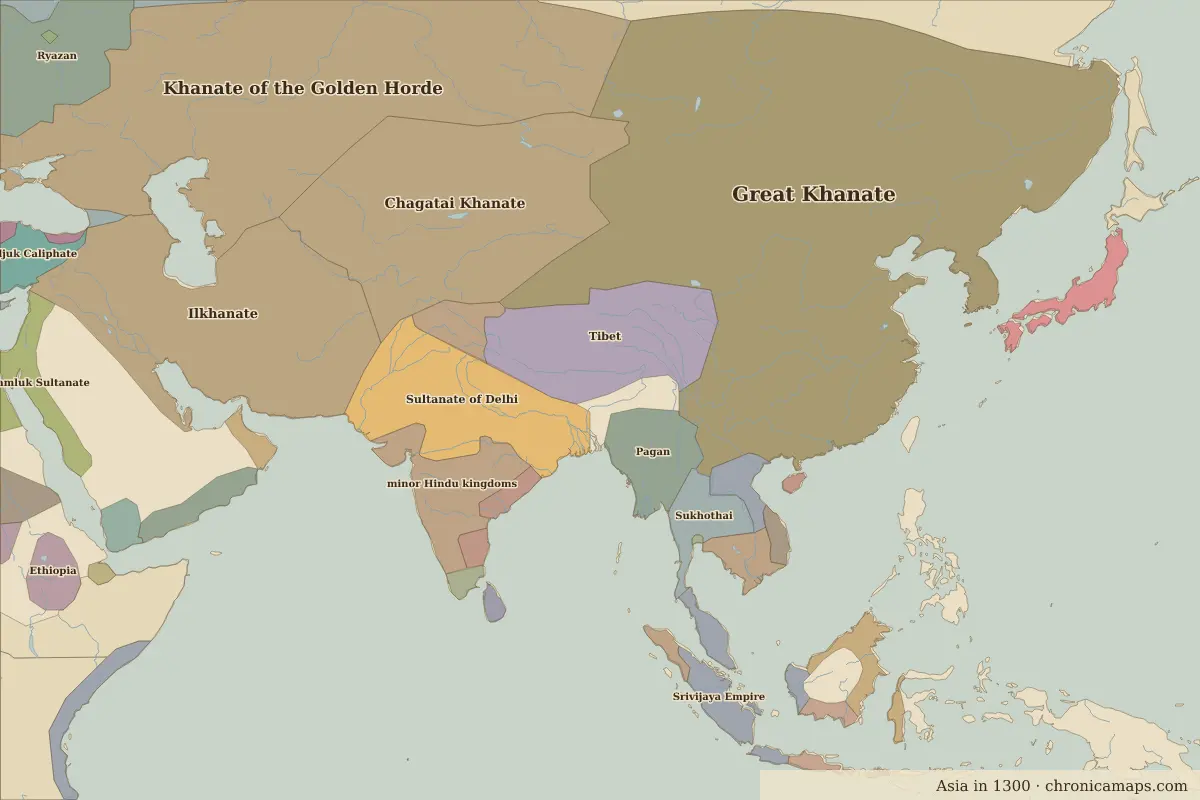
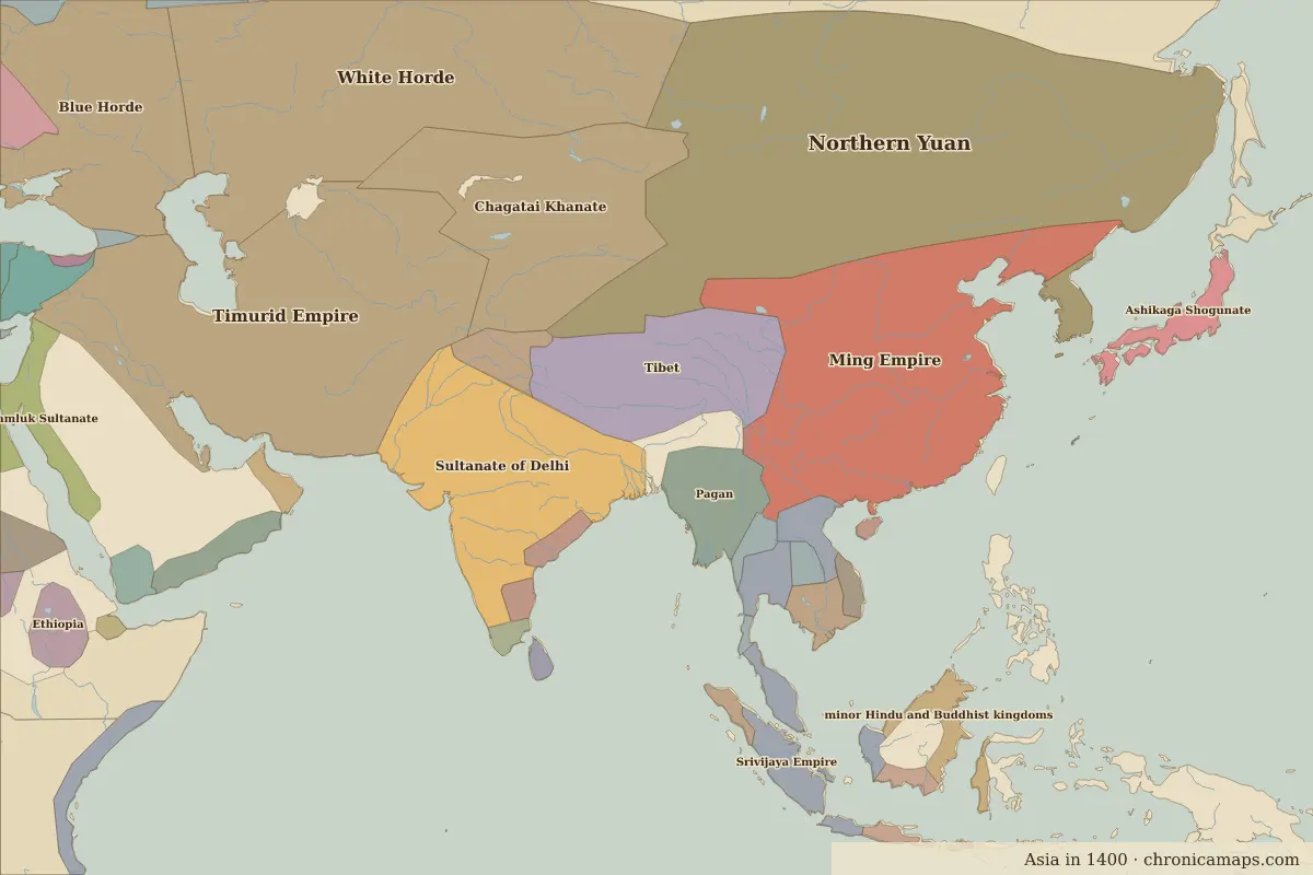
Between 1300 and 1400, 6 states appear on the map of Asia and 3 disappear. Among those that vanish: Great Khanate, minor Hindu kingdoms, Shogun Japan (Kamakura). New on the map: Northern Yuan, Timurid Empire, Ming Empire. Chagatai Khanate loses the most territory.
Open 1400 in the interactive map
States that disappeared
| State | Area in 1300 |
|---|---|
| Great Khanate | 10.55 million km² |
| minor Hindu kingdoms | 980,000 km² |
| Shogun Japan (Kamakura) | 280,000 km² |
New states on the map
| State | Area in 1400 |
|---|---|
| Northern Yuan | 6.27 million km² |
| Timurid Empire | 5.09 million km² |
| Ming Empire | 4.28 million km² |
| White Horde | 3.72 million km² |
| Ashikaga Shogunate | 280,000 km² |
| Ayutthaya | 260,000 km² |
States that grew or shrank
| State | Change in area |
|---|---|
| Chagatai Khanate | −1.14 million km² |
| Sultanate of Delhi | +980,000 km² |
| Sukhothai | −220,000 km² |
| Khmer Empire | −30,000 km² |
People of the period
| Lived | Person | |
|---|---|---|
| c. 1315 – 1390 | Hafez | Poet |
| 1328 – 1398 | Zhu Yuanzhang (Hongwu Emperor) | Founder of the Ming dynasty |
| 1336 – 1405 | Timur (Tamerlane) | Founder of the Timurid Empire |
| 1360 – 1424 | Zhu Di (Yongle Emperor) | Ming emperor |
| 1371 – 1433 | Zheng He | Admiral and explorer |
| 1394 – 1449 | Ulugh Beg | Astronomer and ruler |
| 1397 – 1450 | Sejong the Great | King of Joseon |
Questions
How did the map of Asia change between 1300 and 1400?
Between 1300 and 1400, 6 states appear on the map of Asia and 3 disappear. Among those that vanish: Great Khanate, minor Hindu kingdoms, Shogun Japan (Kamakura). New on the map: Northern Yuan, Timurid Empire, Ming Empire. Chagatai Khanate loses the most territory.
Which states disappeared from the map of Asia between 1300 and 1400?
Great Khanate, minor Hindu kingdoms, Shogun Japan (Kamakura).
Which new states appeared between 1300 and 1400?
Northern Yuan, Timurid Empire, Ming Empire, White Horde, Ashikaga Shogunate, Ayutthaya.
Borders are drawn from the nearest available maps and are approximate.
Last updated 10 November 2026. Sources: border data from historical-basemaps, land and rivers from Natural Earth; texts written for Chronica Maps from standard reference works. How we make the maps.