World Map in 1650
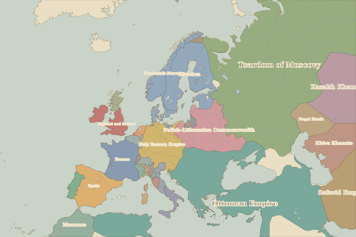
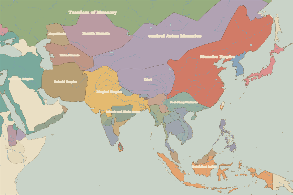
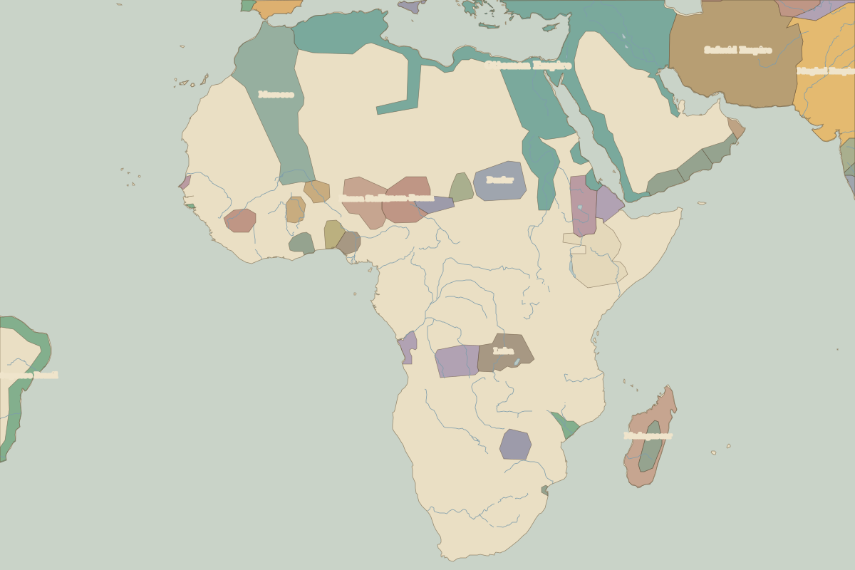
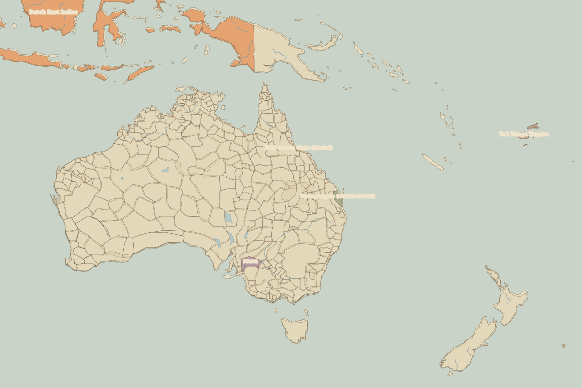
This world map shows state borders in 1650. The largest states and empires were Tsardom of Muscovy, Ottoman Empire, central Asian khanates, Manchu Empire and Viceroyalty of Peru. The map stays in use until the next recorded border change in 1700.
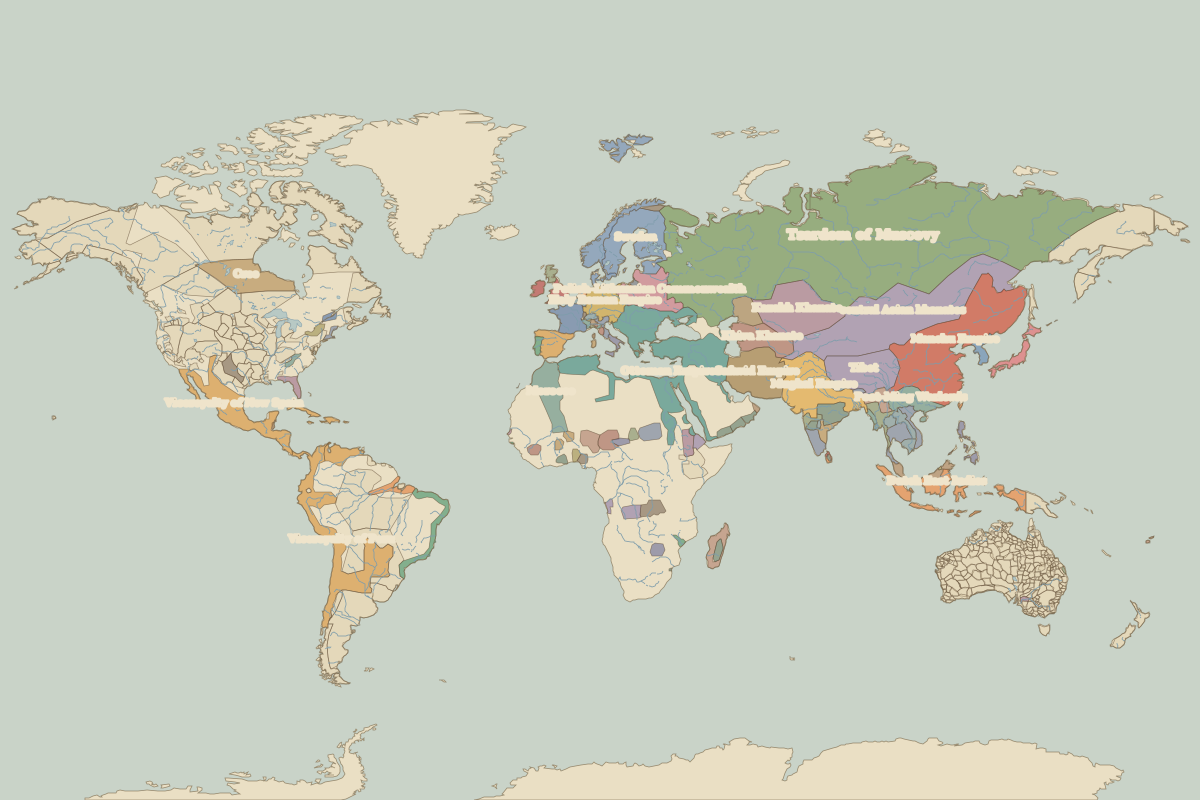
Open the world in 1650 in the interactive map
Largest states and empires in 1650
Areas are approximate, from the historical border data.
| State | Approx. area | Region |
|---|---|---|
| Tsardom of Muscovy | 12.71 million km² | – |
| Ottoman Empire | 5.48 million km² | Europe |
| central Asian khanates | 5.29 million km² | Asia |
| Manchu Empire | 5.20 million km² | Asia |
| Viceroyalty of Peru | 3.78 million km² | – |
| Viceroyalty of New Spain | 2.89 million km² | – |
| Mughal Empire | 2.74 million km² | Asia |
| Safavid Empire | 2.10 million km² | Asia |
| Tibet | 2.07 million km² | Asia |
| Kazakh Khanate | 1.96 million km² | Asia |
| Dutch East Indies | 1.70 million km² | Asia |
| Morocco | 1.34 million km² | Africa |
| Khiva Khanate | 940,000 km² | Asia |
| Cree | 890,000 km² | – |
| Post-Ming Warlords | 880,000 km² | Asia |
| Sweden | 870,000 km² | Europe |
| Polish–Lithuanian Commonwealth | 840,000 km² | Europe |
| Portuguese Brazil | 740,000 km² | – |
| Holy Roman Empire | 630,000 km² | Europe |
| Islamic and Hindu states | 520,000 km² | Asia |
| Spain | 490,000 km² | Europe |
| France | 480,000 km² | Europe |
| Ayutthaya | 460,000 km² | Asia |
| Madagascar | 430,000 km² | Africa |
| Denmark-Norway | 390,000 km² | Europe |
| Ava | 390,000 km² | Asia |
| Nogai Horde | 370,000 km² | Europe |
| Kanem-Bornu | 360,000 km² | Africa |
| Shan states | 360,000 km² | Asia |
| Tokugawa shogunate | 360,000 km² | Asia |
Regional maps
- Europe in 1650 (map image) · open in the interactive map
- Asia in 1650 (map image) · open in the interactive map
- Africa in 1650 (map image) · open in the interactive map
- Oceania in 1650 (map image) · open in the interactive map
- Europe in 1650: rulers and events