The colonisation of Oceania: Oceania in 1783 and 1900
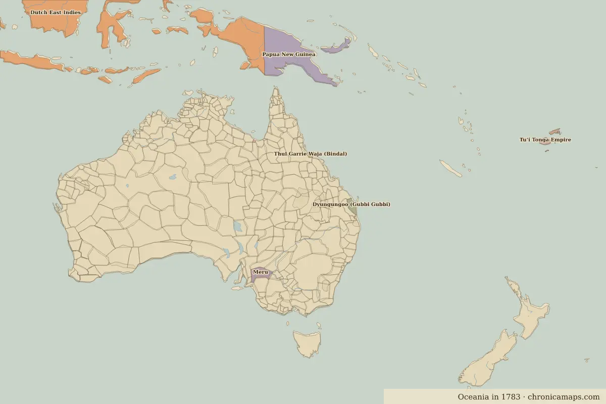
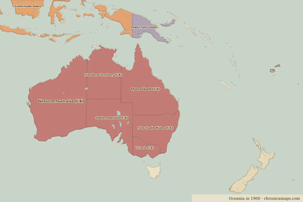
Between 1783 and 1900, 6 states appear on the map of Oceania and 2 disappear. Among those that vanish: Meru, Tuʻi Tonga Empire. New on the map: Western Australia (UK), Queensland (UK), Northern Territory (UK).
Open 1900 in the interactive map
States that disappeared
| State | Area in 1783 |
|---|---|
| Meru | 40,000 km² |
| Tuʻi Tonga Empire | 20,000 km² |
New states on the map
| State | Area in 1900 |
|---|---|
| Western Australia (UK) | 2.52 million km² |
| Queensland (UK) | 1.68 million km² |
| Northern Territory (UK) | 1.23 million km² |
| South Australia (UK) | 1.12 million km² |
| New South Wales (UK) | 820,000 km² |
| Victoria (UK) | 240,000 km² |
What happened in between
Battles of the period
- Waitangi · 1840
Questions
How did the map of Oceania change between 1783 and 1900?
Between 1783 and 1900, 6 states appear on the map of Oceania and 2 disappear. Among those that vanish: Meru, Tuʻi Tonga Empire. New on the map: Western Australia (UK), Queensland (UK), Northern Territory (UK).
Which states disappeared from the map of Oceania between 1783 and 1900?
Meru, Tuʻi Tonga Empire.
Which new states appeared between 1783 and 1900?
Western Australia (UK), Queensland (UK), Northern Territory (UK), South Australia (UK), New South Wales (UK), Victoria (UK).
Borders are drawn from the nearest available maps and are approximate.
Last updated 10 November 2026. Sources: border data from historical-basemaps, land and rivers from Natural Earth; texts written for Chronica Maps from standard reference works. How we make the maps.