The Arab conquest of North Africa: Africa in AD 600 and AD 800
Between AD 600 and AD 800, 3 states appear on the map of Africa and 5 disappear. Among those that vanish: Vazimba, Sasanian dependencies, Empire of Ghana. New on the map: Malagasy, Kanem, Ghana. Makkura gains the most territory.
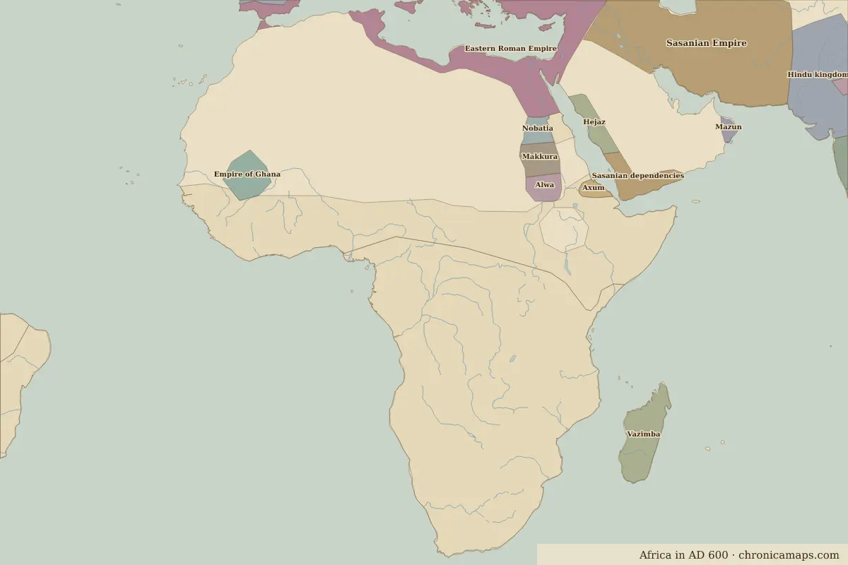
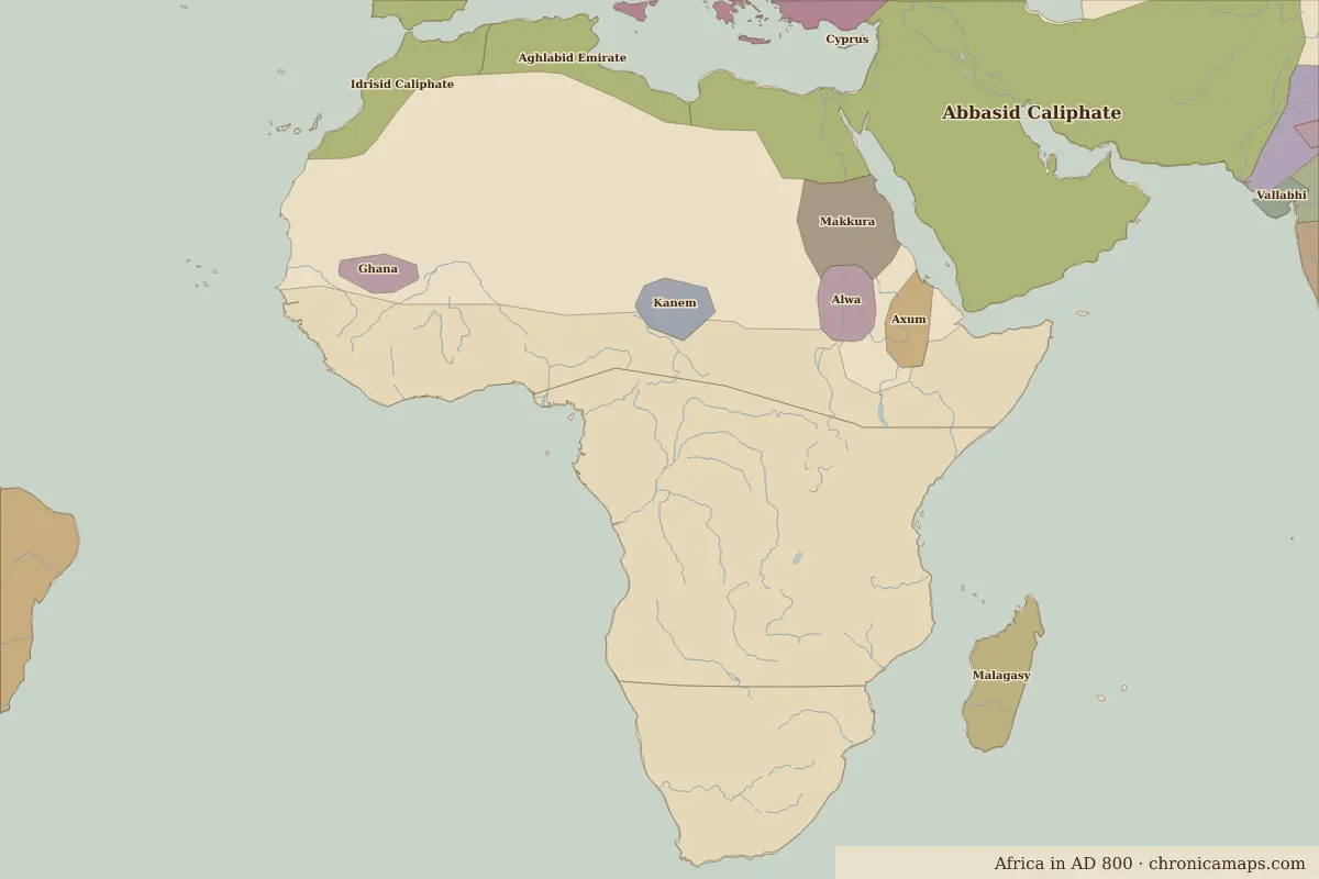
Open AD 800 in the interactive map
States that disappeared
| State | Area in AD 600 |
|---|---|
| Vazimba | 580,000 km² |
| Sasanian dependencies | 340,000 km² |
| Empire of Ghana | 340,000 km² |
| Hejaz | 220,000 km² |
| Nobatia | 140,000 km² |
New states on the map
| State | Area in AD 800 |
|---|---|
| Malagasy | 580,000 km² |
| Kanem | 310,000 km² |
| Ghana | 200,000 km² |
States that grew or shrank
What happened in between
| Year | Event | Where |
|---|---|---|
| AD 622 | Muhammad's migration to Medina: year one of the Islamic calendar | Mecca |
People of the period
| Lived | Person | |
|---|---|---|
| c. AD 570 – AD 632 | Muhammad | Prophet of Islam |
Questions
How did the map of Africa change between AD 600 and AD 800?
Between AD 600 and AD 800, 3 states appear on the map of Africa and 5 disappear. Among those that vanish: Vazimba, Sasanian dependencies, Empire of Ghana. New on the map: Malagasy, Kanem, Ghana. Makkura gains the most territory.
Which states disappeared from the map of Africa between AD 600 and AD 800?
Vazimba, Sasanian dependencies, Empire of Ghana, Hejaz, Nobatia.
Which new states appeared between AD 600 and AD 800?
Malagasy, Kanem, Ghana.
Borders are drawn from the nearest available maps and are approximate.
Last updated 10 November 2026. Sources: border data from historical-basemaps, land and rivers from Natural Earth; texts written for Chronica Maps from standard reference works. How we make the maps.