Map of Europe in AD 200
This border map shows Europe and the Mediterranean in AD 200 (era: Roman Empire at its height). The largest states on the map were Roman Empire, Parthian Empire and Armenia. The map stays in use until the next border change recorded in AD 300.
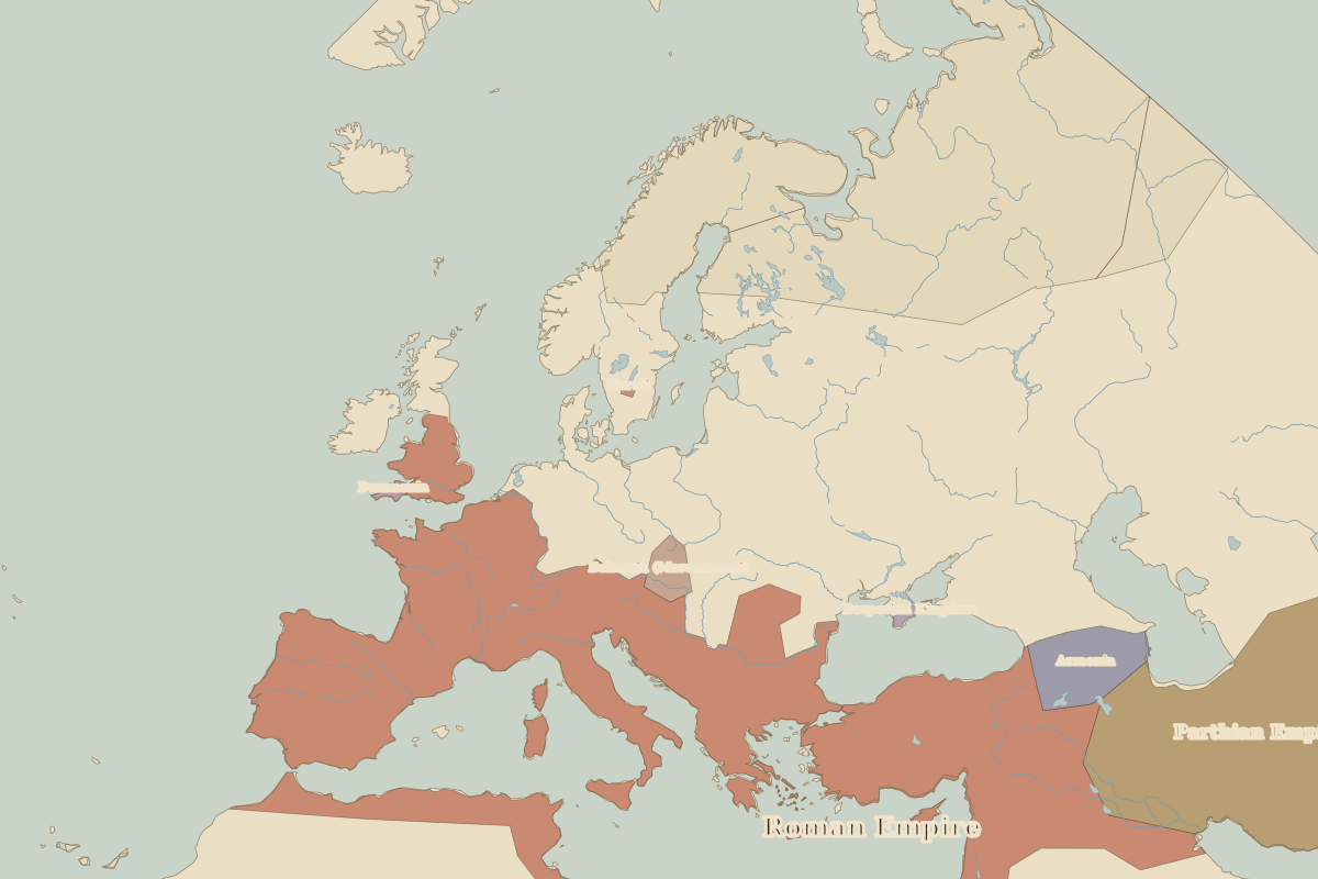
Open Europe in AD 200 in the interactive map
States on the map in AD 200
Areas are approximate and cover each state's whole territory, including land outside the map frame.
| State | Approx. area |
|---|---|
| Roman Empire | 4.87 million km² |
| Parthian Empire | 1.67 million km² |
| Armenia | 220,000 km² |
| Bohemia (Marcomanni) | 70,000 km² |
| Dumnonia | 10,000 km² |
| Bosporian Kingdom | 10,000 km² |
| Heruli | 10,000 km² |
Rulers in AD 200
| Realm | Ruler | Reign |
|---|---|---|
| Rome | Septimius Severus | 193–211 |
Key events, AD 200 to AD 299
| Year | Event | Where |
|---|---|---|
| AD 212 | Edict of Caracalla: citizenship for all free men | Rome |
| AD 293 | Diocletian creates the Tetrarchy | Trier |
← Europe in AD 100Europe in AD 300 →
Part of the era: Roman Empire at its height. See also the world in AD 200.