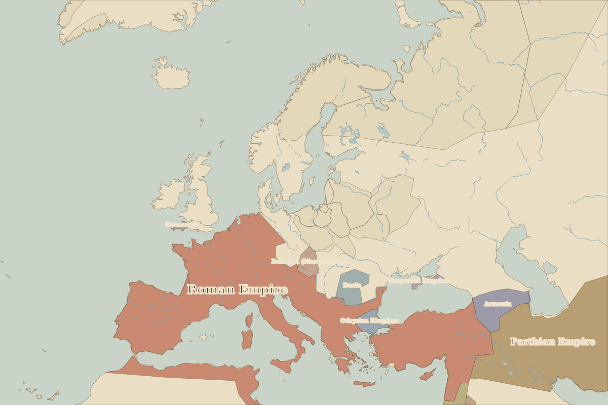
Map of Europe in 1 BC
This border map shows Europe and the Mediterranean in 1 BC (era: Roman Empire at its height). The largest states within the map area were Roman Empire, Parthian Empire and Armenia. The map stays in use until the next border change recorded in AD 100.
Open Europe in 1 BC in the interactive map
States on the map in 1 BC
Areas are approximate and count only territory inside the map area.
| State | Approx. area on map |
|---|---|
| Roman Empire | 4.27 million km² |
| Parthian Empire | 1.91 million km² |
| Armenia | 200,000 km² |
| Nabatean Kingdom | 170,000 km² |
| Suren Kingdom | 130,000 km² |
| Dacia | 120,000 km² |
| Muscat | 100,000 km² |
| Odrysian Kingdom | 70,000 km² |
| Bohemia (Marcomanni) | 70,000 km² |
| Judea | 50,000 km² |
| Meroe | 30,000 km² |
| Bosporian Kingdom | 20,000 km² |
| Himyarite Kingdom | 10,000 km² |
| Dumnonia | 10,000 km² |
Rulers in 1 BC
| Realm | Ruler | Reign |
|---|---|---|
| Rome | Augustus | 27 BC–14 |
Key events, 1 BC to AD 99
| Year | Event | Where |
|---|---|---|
| AD 9 | Battle of the Teutoburg Forest | Battle of the Teutoburg Forest |
| AD 79 | Vesuvius erupts | Pompeii |
Battles and sites in this period
- Battle of the Teutoburg Forest · AD 9
- Pompeii · AD 79
← Europe in 100 BCEurope in AD 100 →
Part of the era: Roman Empire at its height.